In this essay, I review the history of a Mars-related frenzy that unfolded from about 1890 to 1910, showing the many ways in which visual images and icons were central to the production of a contested geographical knowledge about Mars. The paper begins with a brief introduction to Mars science at the turn of the twentieth century, highlighting analytical perspectives that help us understand astronomers’ speculation that the Martian landscape was crossed with intersecting canals. It then explores the maps and mapping of Mars, beginning with a discussion of some key transitions in Mars map production in the late nineteenth century. It examines a major controversy in 1877-1878 over cartographic appearance and placenames on various Mars maps, showing that the visual authority of certain maps contributed to beliefs that Mars was inhabited. It then offers a cartographic explanation for the reduction of belief in Martian life after 1909, before concluding with some thoughts about the role of icons and imagery in fusing astronomical science with themes, methods and theories from the discipline of geography. [2]
Understanding the Mars canal craze
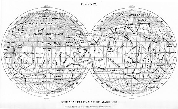
Toward the end of the nineteenth century, some American and European astronomers reported seeing spoke-like patterns on the Martian surface during their telescopic observations [fig.1]. Not every observer could see these patterns, but those who observed from locations with calm atmospheric conditions or those who used high-powered telescopes were more likely to see the intersecting lines than viewers using small telescopes.