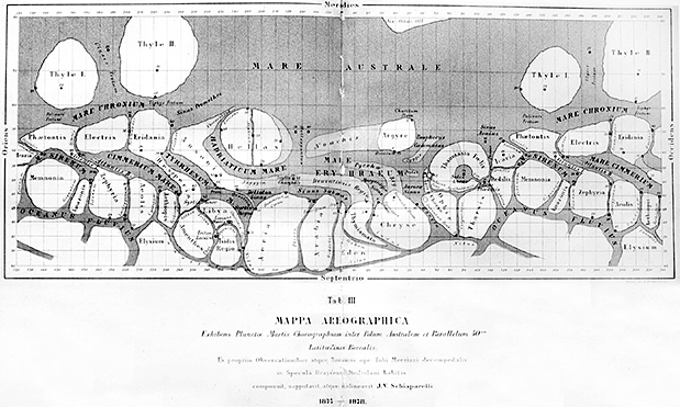
Green’s and Schiaparelli’s maps were both very detailed, and they both used the same combination of cartographic projections: a Mercator projection for the tropics and mid-latitudes and an azimuthal projection for the Martian poles. But despite these similarities, the two maps were irreconcilably different. The style of illustration was probably the most striking difference, as Green had chosen to use subtle naturalistic shading whereas Schiaparelli used definitive lines, hard-edged features, and artificial colors. In addition, the placenames on the two maps were radically different.
Green had followed a decades-long convention of using astronomers’ surnames to label the surface features of Mars. Where he mapped known features, he used names already designated on previous maps; where he mapped new features, he applied new names of English and European astronomers.
Schiaparelli, on the other hand, rejected the surname convention altogether. He wiped all astronomers’ names off the map and applied a fully new nomenclature based on the classical and mythological geography of the Mediterranean world. Finally, the maps differed in terms of the amount and type of detail shown. Schiaparelli’s map had numerous straight-line features that were nowhere to be seen in Green’s map. Straight lines, in fact, dominated Schiaparelli’s map, even though such lines had never appeared on previous maps of Mars.
